
Have you ever wondered how the borders of African countries came to be? Why do they have such sharp corners and irregular lines? These borders were not created by the African people themselves, but were imposed by European colonial powers during the colonial era.
One of the most important aspects for understanding African borders is the Berlin Conference from 1884 to 1885. This meeting took place in Berlin, Germany, where representatives from fourteen countries gathered to discuss how European powers would divide up and control African territories. The conference was organized by Imperial Chancellor Otto von Bismarck, who sought to prevent conflicts between European nations competing for land and resources in Africa.
Remarkably, no African leaders or representatives were invited, even though the decisions would shape the political future of the entire continent. During the conference, the European powers agreed on rules that allowed them to claim African territories based on the principle of „effective occupation.“ This meant that a country could declare control over a territory if it established an administration or a military presence there.
The conference accelerated what later became known as the „Scramble for Africa“: a period during which European nations rapidly took possession of large parts of the continent. By the early 20th century, nearly all African countries had been colonized by European powers, with the exception of Ethiopia and Liberia. The borders drawn during this period were often established without regard for local populations, ethnic groups, languages, or historical boundaries. The Berlin Conference thus played a central role in shaping the map of Africa and continues to influence the political and social dynamics on the continent to this day.
Before European colonization, Africa was home to a wide variety of political systems, kingdoms, and empires. Contrary to the colonial narrative, which portrayed Africa as a continent without political organization, many African societies had complex administrative structures, trade networks, and cultural regions. Large empires, such as the Mali Empire in West Africa, controlled vast territories and were known for their wealth, scholarship, and trade.
Cities such as Timbuktu became major centers of education and trade. In Central Africa, the Kingdom of Kongo established diplomatic relations with European powers as early as the 15th century. In the Horn of Africa, Ethiopia maintained a long history of statehood and sovereignty. These societies did not always define borders as the rigid, straight lines that appear on modern maps. Rather, borders were often flexible zones shaped by trade routes, ecological regions, or alliances between communities.
People moved through these areas for livestock herding, trade, and cultural exchange. Authority was sometimes shared among different groups rather than strictly controlled by fixed boundaries. This flexibility allowed communities to coexist and adapt to changing conditions. When European colonial powers later imposed fixed territorial borders, they disrupted these long-standing patterns of interaction. An understanding of Africa’s political geography before the colonial era reveals how colonial borders altered existing systems and created new divisions that had not previously existed in this form.
The borders arbitrarily drawn by European powers in the late 19th and early 20th centuries—often without regard for ethnic, cultural, or linguistic groups—have had a lasting impact on the continent. These imposed borders are a major factor in many of today’s border conflicts in Africa. They disrupted indigenous identities and created divisions that persist to this day.
In the late 19th and early 20th centuries, European colonial powers established territorial borders in Africa that largely ignored local realities. These borders were often drawn on maps in European capitals using rulers and geometric lines, rather than being based on geographical or cultural knowledge of the continent. Colonial administrators focused primarily on securing access to valuable resources such as minerals, rubber, agricultural land, and trade routes.
Since the borders served colonial interests rather than those of the local population, they often cut across existing communities and landscapes. In some cases, mountains or rivers served as borders, but many borders were simply straight lines drawn across deserts, forests, and savannas. The creation of these borders had long-term effects on African societies. Communities that had historically been connected through trade or migration suddenly found themselves under different colonial administrations.
New colonial governments introduced different languages, legal systems, currencies, and economic policies. These differences created administrative divisions that persisted even after African countries gained independence in the 20th century. As a result, the colonial system of borders shaped the formation of modern African states. Many countries adopted borders that did not reflect historical identities or social relationships.
While these borders were internationally recognized after independence, they continued to influence political tensions, economic cooperation, and national identity. Understanding the process of colonial border-drawing helps explain why many of the continent’s current challenges stem from historical decisions made far beyond Africa’s borders.
One of the most enduring consequences of colonial border-drawing is the division of ethnic and cultural communities across multiple modern states. Because colonial administrators often ignored social and cultural boundaries, many African ethnic groups were separated by international borders. For example, the Somali people were divided among Somalia, Ethiopia, Kenya, and Djibouti. Similarly, the Ewe people were separated between Ghana and Togo, while the Maasai live in Kenya and Tanzania. These divisions did not eliminate the cultural ties between the communities.
Families, languages, and traditions continued to exist across borders. However, the existence of national borders brought new political and administrative challenges. People who shared the same culture could suddenly become citizens of different states with different governments and policies. In some cases, these divisions contributed to tensions or conflicts when groups sought political representation or autonomy. At the same time, many communities developed cross-border cooperation through trade, migration, and cultural exchange.
Markets and trade routes often connect communities on both sides of borders, demonstrating that cultural ties can endure despite political divisions. The experience of divided communities illustrates how colonial borders transformed African societies, a transformation that continues to influence identity and politics to this day. It also shows why discussions about African borders often focus on cooperation and integration rather than on redrawing national borders.
After gaining independence in the mid-20th century, many African countries adopted colonial borders that were never intended to be national borders. These inherited borders sometimes led to disputes between neighboring countries. In some cases, disagreements arose over control of natural resources, strategic locations, or historical territorial claims. A well-known example is the border conflict between Ethiopia and Eritrea from 1998 to 2000, which was triggered by disputes over a small border region but escalated into a major war.
Another example is the conflict between Nigeria and Cameroon over the Bakassi Peninsula, an oil-rich region. Such conflicts illustrate how borders drawn during the colonial era sometimes created uncertainties regarding sovereignty and territorial control. Nevertheless, it should be noted that many African countries have also successfully resolved border conflicts peacefully. Regional organizations and international courts have played important roles in mediating conflicts and establishing clear borders.
The experience of postcolonial Africa shows that borders inherited from colonial rule can create challenges but do not necessarily lead to conflict. Instead, the management of these borders depends on political cooperation, diplomacy, and regional institutions. Over time, many African countries have decided to strengthen cross-border cooperation rather than redraw their borders.
Recognizing the need to address the challenges caused by these colonial borders, the African Union (AU) the African Union Border Program (AUBP). In June 2010, the AU Commission designated June 7 as an annual day to promote research and knowledge regarding the facilitation of cross-border trade, the movement of people, and economic activities on the African continent.
The AUBP's objectives include preventing conflicts and resolving border disputes, improving border management, promoting cooperation among nations, and fostering regional integration to create a more united and peaceful Africa.

When African countries gained independence in the 1950s and 1960s, their leaders faced a difficult question: Should colonial borders be redrawn or maintained? Many borders did not reflect ethnic or historical realities, but redrawing them could have triggered far-reaching territorial disputes. African leaders chose a pragmatic approach. In 1964, the Organization of African Unity agreed that the newly independent states should respect the borders they had inherited at the time of independence.
This principle was known as „uti possidetis,“ which meant that existing administrative boundaries would remain in place. The decision was intended to prevent a wave of conflicts that might arise if every country were to redraw borders based on ethnic or historical claims. Although the policy did not resolve all border disputes, it provided a framework for maintaining stability on the continent.
By accepting the inherited borders, African states were able to focus on building national institutions and promoting development. This decision reflects the complex legacy of colonialism in Africa. While the borders themselves date back to the colonial era, African leaders decided to manage them collectively rather than dissolve them. The principle established in the 1960s continues to influence African diplomacy and regional cooperation to this day.
June 7 also serves as an opportunity to reflect on the principles of Pan-Africanism—the ideological movement that aims to unite African nations and peoples. Rather than completely redrawing borders, the focus is on promoting unity and cooperation among nations. This vision was inspired by revolutionary freedom fighters and activists of the 20th century who called for independence and solidarity. Alongside debates about borders, many African thinkers and political leaders championed the idea of Pan-Africanism.
This ideological movement emphasized solidarity among people of African descent and encouraged cooperation among African nations. Pan-Africanism gained momentum in the early 20th century through intellectual and political networks that connected Africa, the Caribbean, Europe, and the Americas.
Thinkers such as W. E. B. Du Bois and activists such as Marcus Garvey argued that people of African descent share common historical experiences shaped by colonialism and racism. Later, African leaders, including Kwame Nkrumah of Ghana, promoted the idea that African countries should cooperate politically and economically.
Nkrumah famously argued that African independence would only be meaningful if it led to continental unity. Although the vision of a fully united Africa has not yet been realized, Pan-Africanism continues to influence regional organizations and political debates. The movement encourages African states to cooperate on issues such as trade, infrastructure, education, and cultural exchange. It also promotes a broader understanding of African identity that transcends colonial borders.
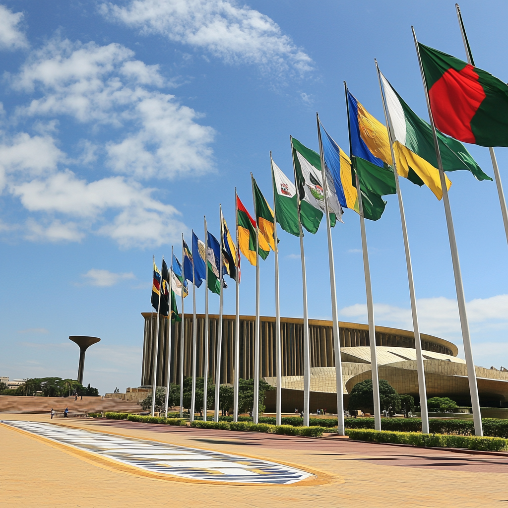
In recent decades, African governments have increasingly turned to regional integration to overcome the constraints created by colonial borders. Rather than redrawing borders, many countries are working to make them less restrictive through economic and political cooperation. One of the most significant projects in this area is the African Continental Free Trade Area (AfCFTA), which aims to create one of the largest free trade zones in the world.
The agreement aims to reduce trade barriers between African countries so that goods, services, and investments can move more easily across borders. Improved transportation networks, infrastructure projects, and digital connectivity also strengthen ties between neighboring countries. Regional organizations such as the African Union support these efforts by promoting peace, economic cooperation, and political dialogue. The goal is to transform borders from barriers into points of connection.
By promoting cooperation, African leaders hope to address the legacy of colonial borders while creating new opportunities for development and integration. The future of African borders may therefore lie not in altering their geographical boundaries, but in redefining their role within a more interconnected continent.
Our Tours in Berlin explore the history and impact of Africa's colonial borders, as well as their modern implications. Join us as we delve deeper into this fascinating topic and gain an understanding of how these historical lines continue to shape the continent to this day.